Catawissa - Map of Catawissa
Item Description
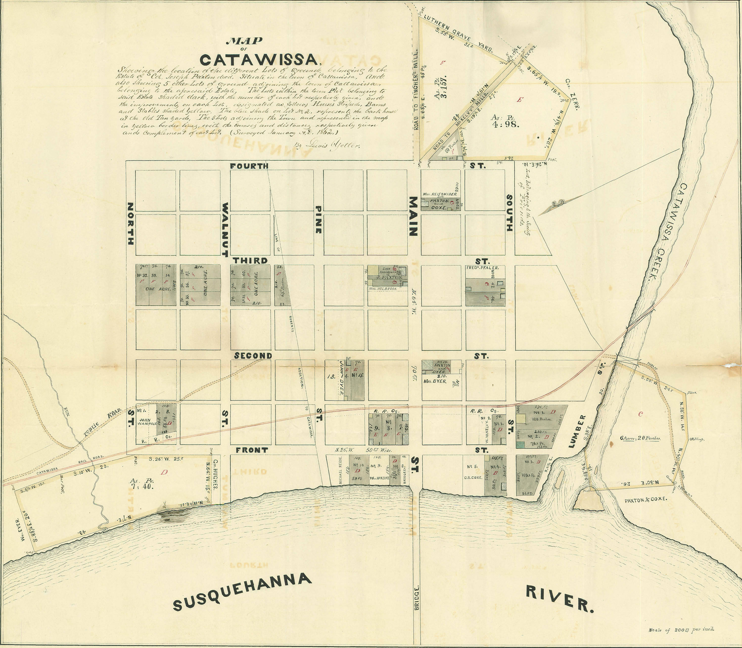
Survey map showing the location of the different lots of ground belonging to the estate of Col. Joseph Paxton, decd. situate in the town of Cattawissa [sic], and also showing 5 other lots of ground adjoining the town of Cattawissa belonging to the aforesaid estate. The lots within the town plot to said estate shaded dark, with the number of each lot respectively given, and the improvements on each lot designated as follows, houses striped, barns and stable shaded yellow. The blue shade on lot 2 represents the bark house of the old Tan Yards. The 5 Lots adjoining the town are represented in the map in yellow border lines, with the courses and distances respectively given and complement of each lot. Surveyed January A.D. 1862 by Lewis Yetter.
Andruss Library digital images and corresponding text may be used for non-commercial, educational, and personal use only without permission, provided that proper attribution of the source accompanies the image. The digital images are not intended for reproduction or redistribution. Commercial publication requires permission. Contact the Bloomsburg University Archives at https://library.commonwealthu.edu/bloomsburgarchives or (570) 389-4210. Andruss Library assumes no responsibility for infringement of copyright by content users.