P185 - Plan of the Post at Harlem
Item Description
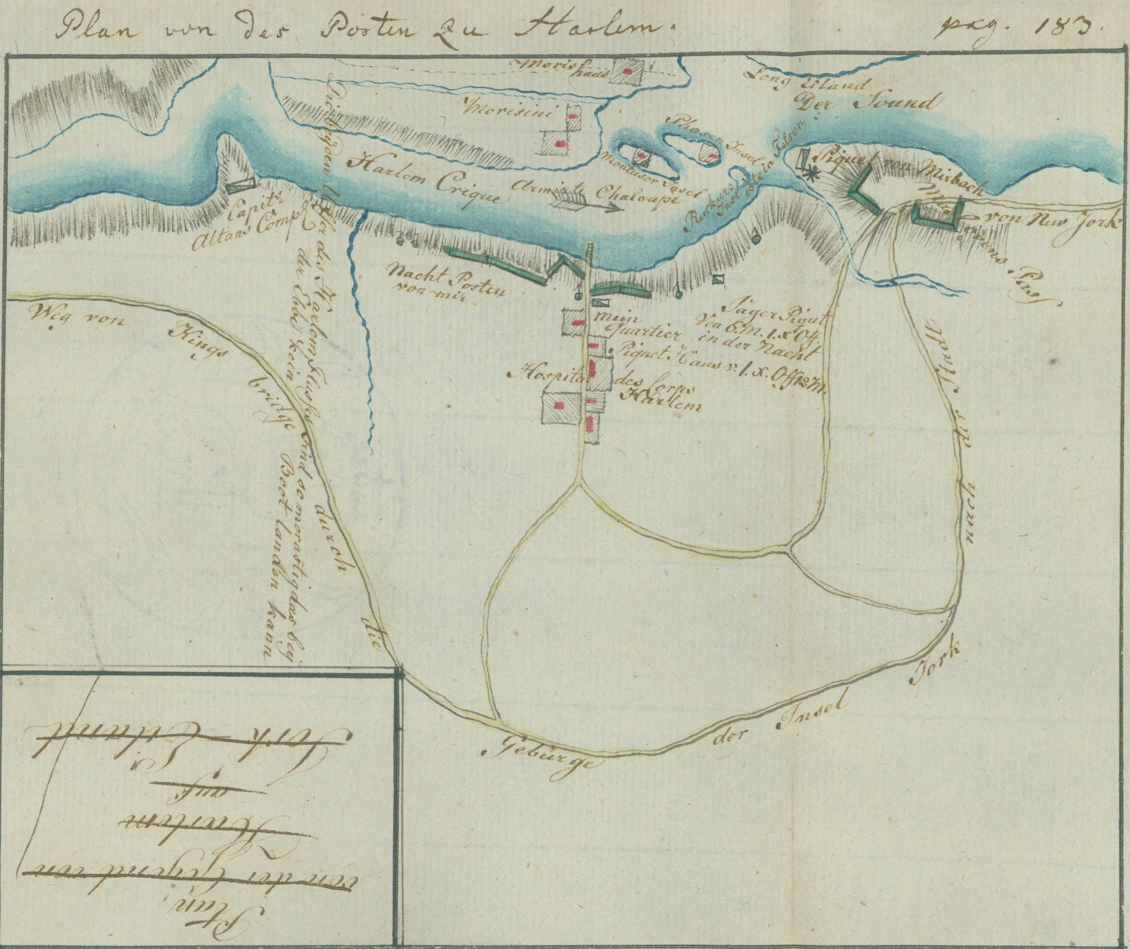
This plan shows the Hessian Field-Jäger Corps stationed in and around Harlem and along the right bank of the Harlem River. Morrisania lies across the river, with the Morris House, now in the lower Bronx of New York City, shown above. An armed sloop is noted in the river. The islands shown are not in their correct geographical locations. Montresor's Island is now Randalls Island; "Phasen Island" was Barren Island, now Ward's Island; and "Ruckurs Island is a rock" is Rikers Island. At the left of the plan is the post of Captain John Althouse, New York Volunteers. The vertical writing states, "The two banks of the Harlem River are so marshy that no boat can land at low tide." The round markers with pennants along the river bank are sentries. Ewald has labeled the defense barrier at the river "My night post."
The village of Harlem is located at the center of the plan, which shows Ewald's quarters, the picket house, and the hospital of the Jäger Corps. To the right is a night picket of six jägers and a noncommissioned officer. Near the upper right corner is a picket of Regiment von Mirbach guarding the defense barriers of McGowan's Pass. The site of the pass is now in the northeastern part of Central Park. The long road running from the left to the right is the "Road from Kings Bridge through the highlands of York Island to the city of New York."
Source: Ewald, Johann von. Tagebuch von dem amerikanischen kriege. 1791. This is a ms. transcription of Ewald's notes.
Andruss Library digital images and corresponding text may be used for non-commercial, educational, and personal use only without permission, provided that proper attribution of the source accompanies the image. The digital images are not intended for reproduction or redistribution. Commercial publication requires permission. Contact the Bloomsburg University Archives at https://library.commonwealthu.edu/bloomsburgarchives or (570) 389-4210. Andruss Library assumes no responsibility for infringement of copyright by content users.