P041 - Plan of the area of Mount Holly
Item Description
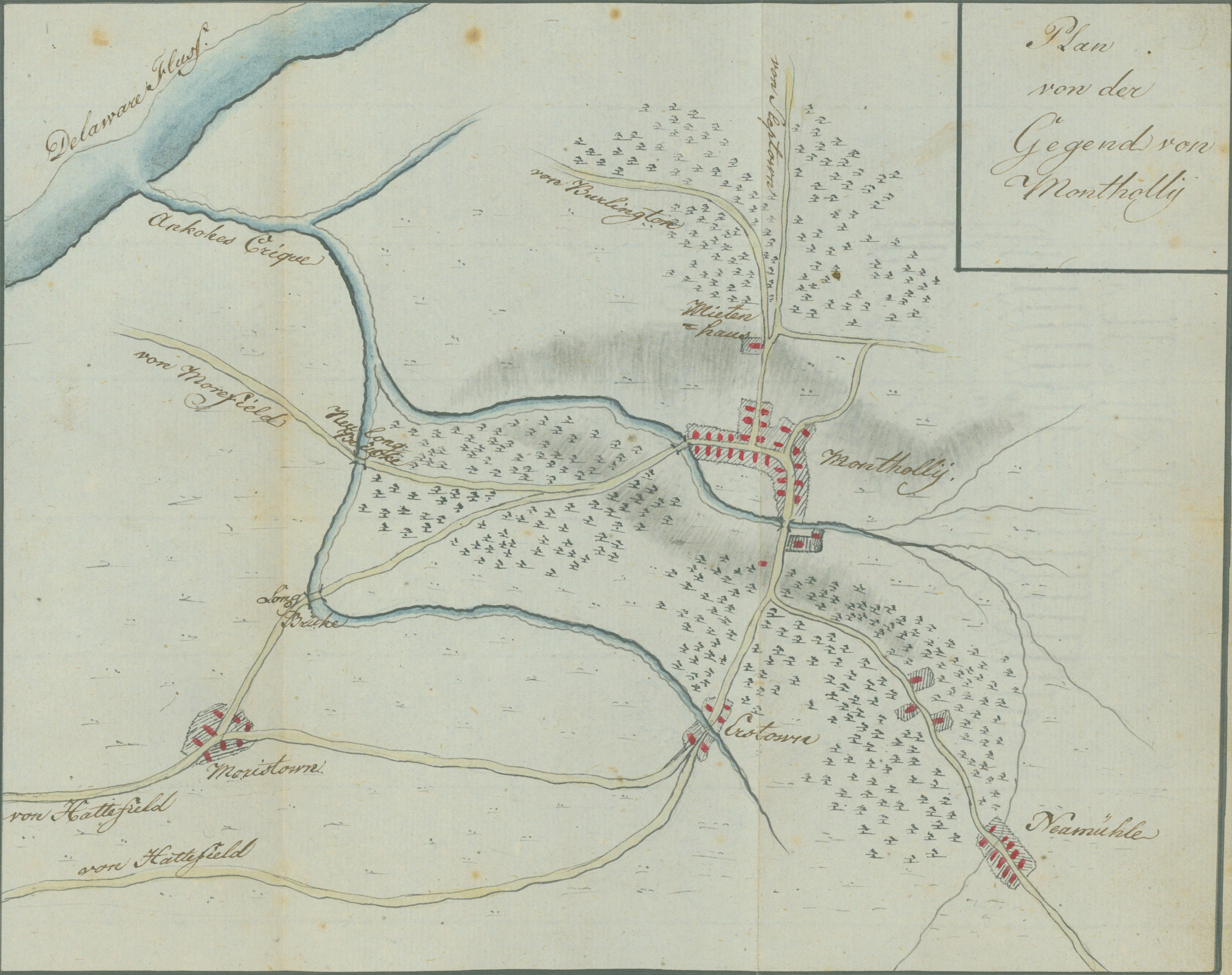
Just north of Mount Holly at the junction of the Slabtown (Jacksonville) road, the road to Burlington, and Woodpecker Lane, is the old Friends Meeting House, which was situated at the base of the mount where the so-called Battle of Mount Holly occurred on December 23, 1776. Ewald reconnoitered the area across the North Branch of Ankokes (Rancocas) Creek to the Long Bridge (now Hainesport), which is on the South West Branch of the same creek. In the lower right of the plan is New Mills (now Pemberton), where Ewald captured Lieutenant Colonel Thomas Reynolds and two captains early on Christmas morning.
Source: Ewald, Johann von. Tagebuch von dem amerikanischen kriege. 1791. This is a ms. transcription of Ewald's notes.
Andruss Library digital images and corresponding text may be used for non-commercial, educational, and personal use only without permission, provided that proper attribution of the source accompanies the image. The digital images are not intended for reproduction or redistribution. Commercial publication requires permission. Contact the Bloomsburg University Archives at https://library.commonwealthu.edu/bloomsburgarchives or (570) 389-4210. Andruss Library assumes no responsibility for infringement of copyright by content users.