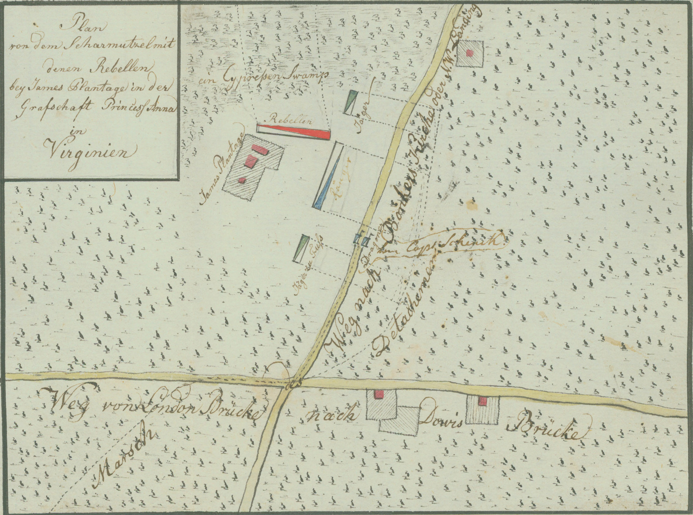
P283 - Plan of the skirmish with the rebels at James's Plantation in Princess Anne County in Virginia
Item Description
Along lower road: "Road from London Bridge to Dauge's Bridge." Along upper road: "Road to Bonkers [Pungo?] church or northwest Landing."
Source: Ewald, Johann von. Tagebuch von dem amerikanischen kriege. 1791. This is a ms. transcription of Ewald's notes.
Andruss Library digital images and corresponding text may be used for non-commercial, educational, and personal use only without permission, provided that proper attribution of the source accompanies the image. The digital images are not intended for reproduction or redistribution. Commercial publication requires permission. Contact the Bloomsburg University Archives at https://library.commonwealthu.edu/bloomsburgarchives or (570) 389-4210. Andruss Library assumes no responsibility for infringement of copyright by content users.